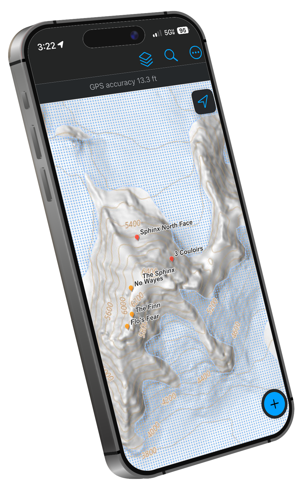
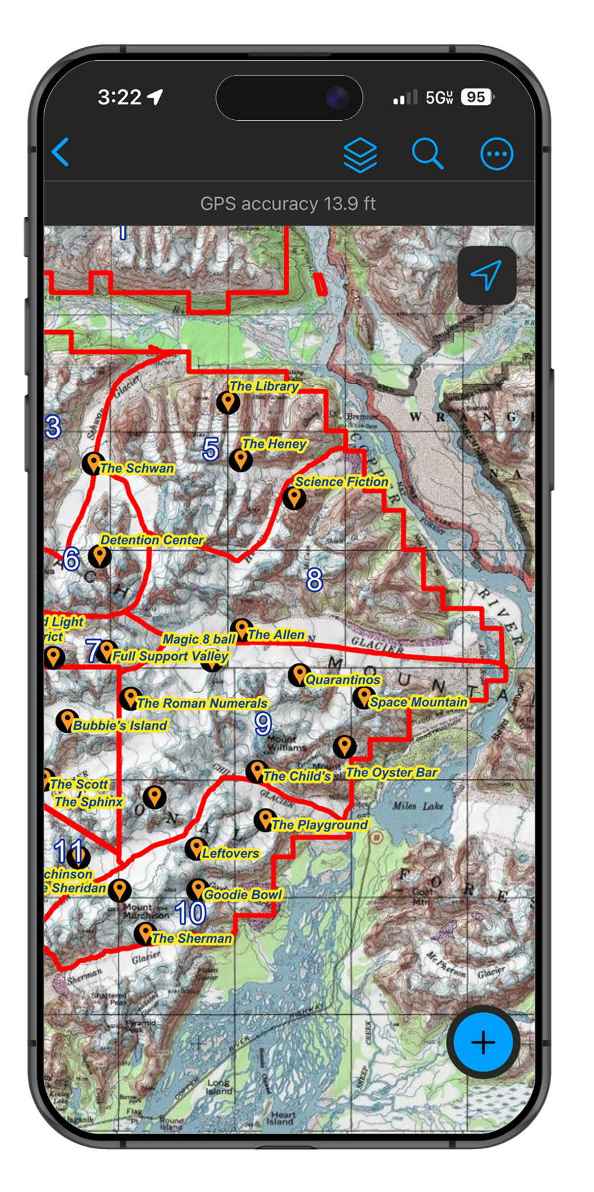
Mapping / GIS
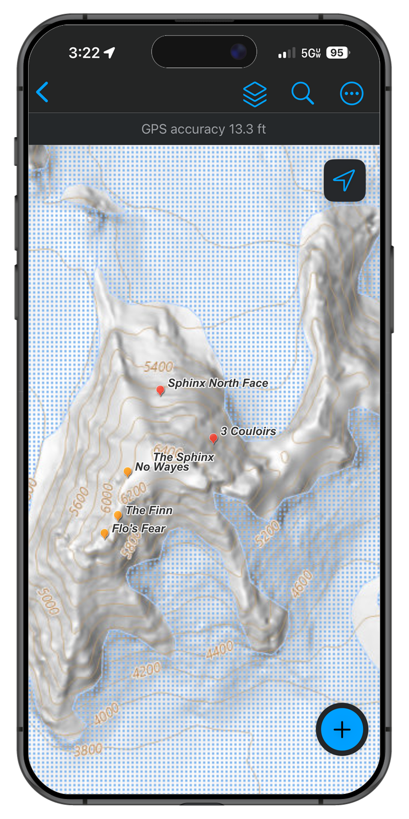
ESRI Field Maps - Mobile App
Take your GIS out into the field with you and enjoy fully-featured offline use with sync upon return to base: go beyond what CalTopo offers.
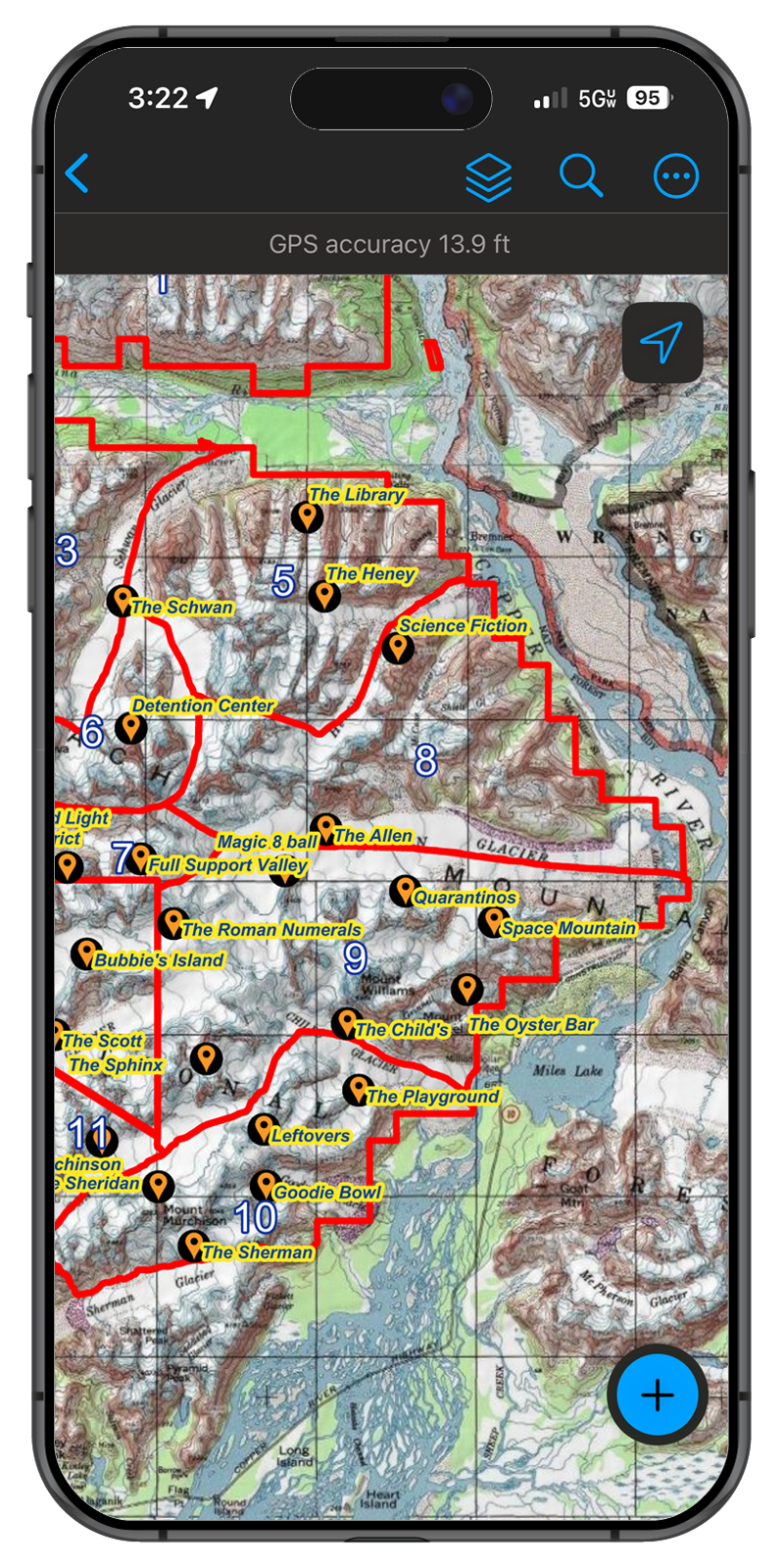
Stay safely within permit and legal boundaries
Name and categorize your runs, LZ and PZs
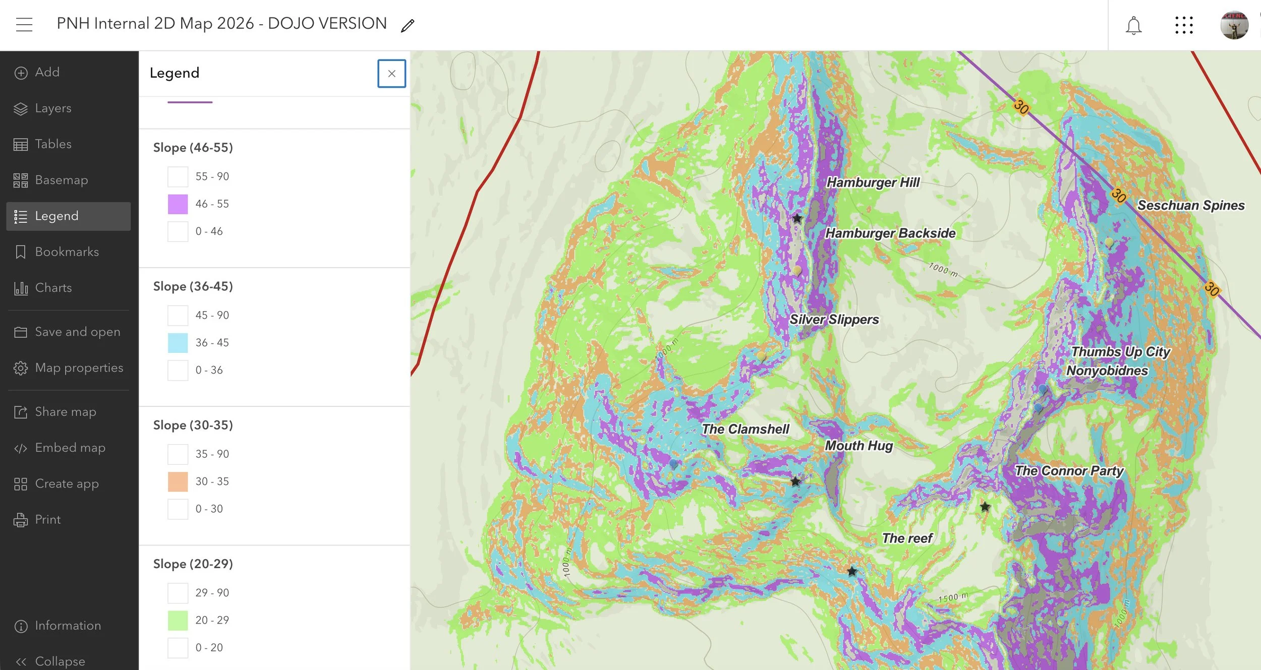
Harness the full power of ArcGIS to enhance your operation.
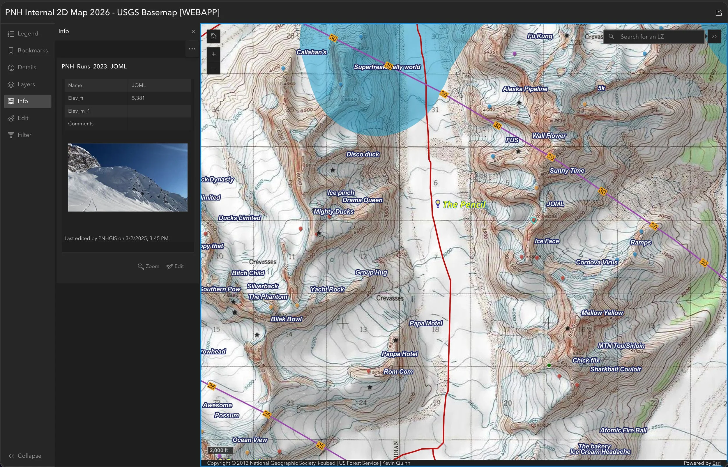
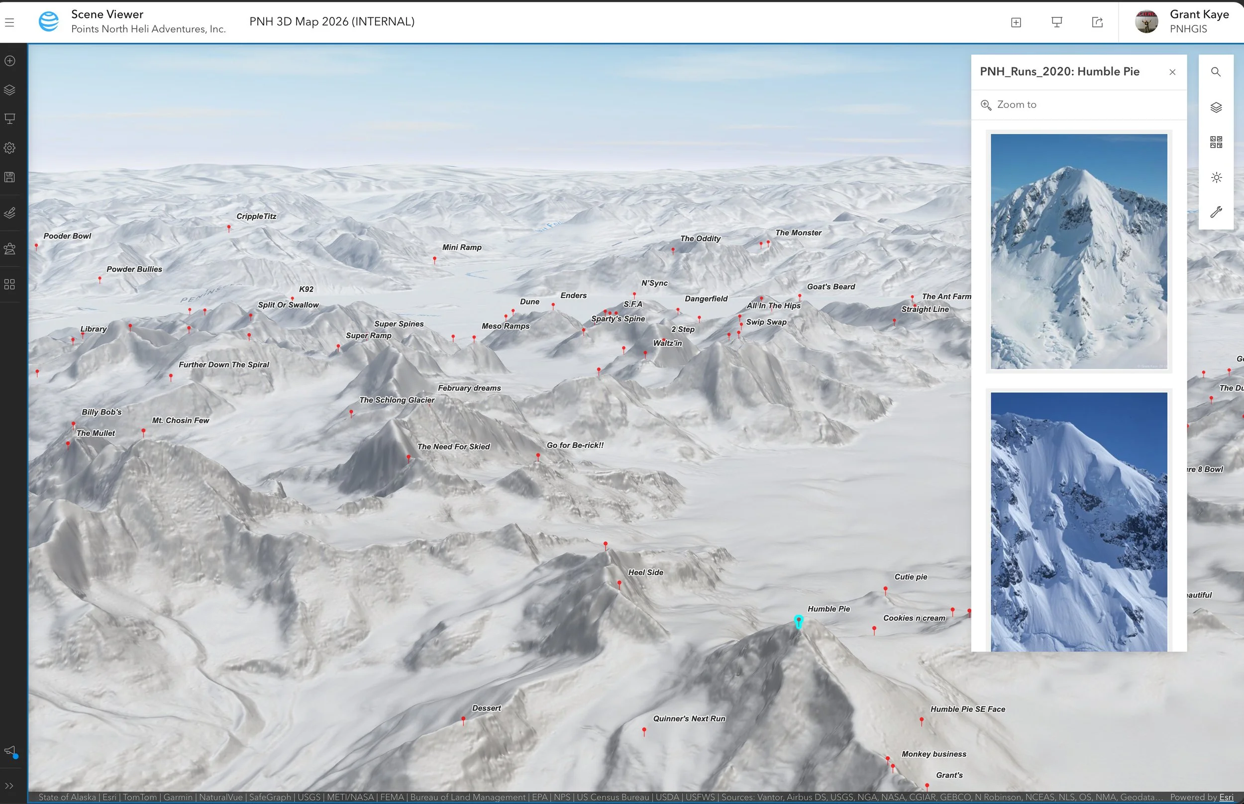
Map runs, landings, and pickups in 2D or 3D
Collect and archive media (photos & videos)
Analyze terrain to underpin decision-making
Implement avalanche observations cross-platform
Field/Office sync for on and offline use
Build interactive web and mobile apps and 3D visualizations
Either private or public (as you wish)
Tracking / logging also available for permit compliance
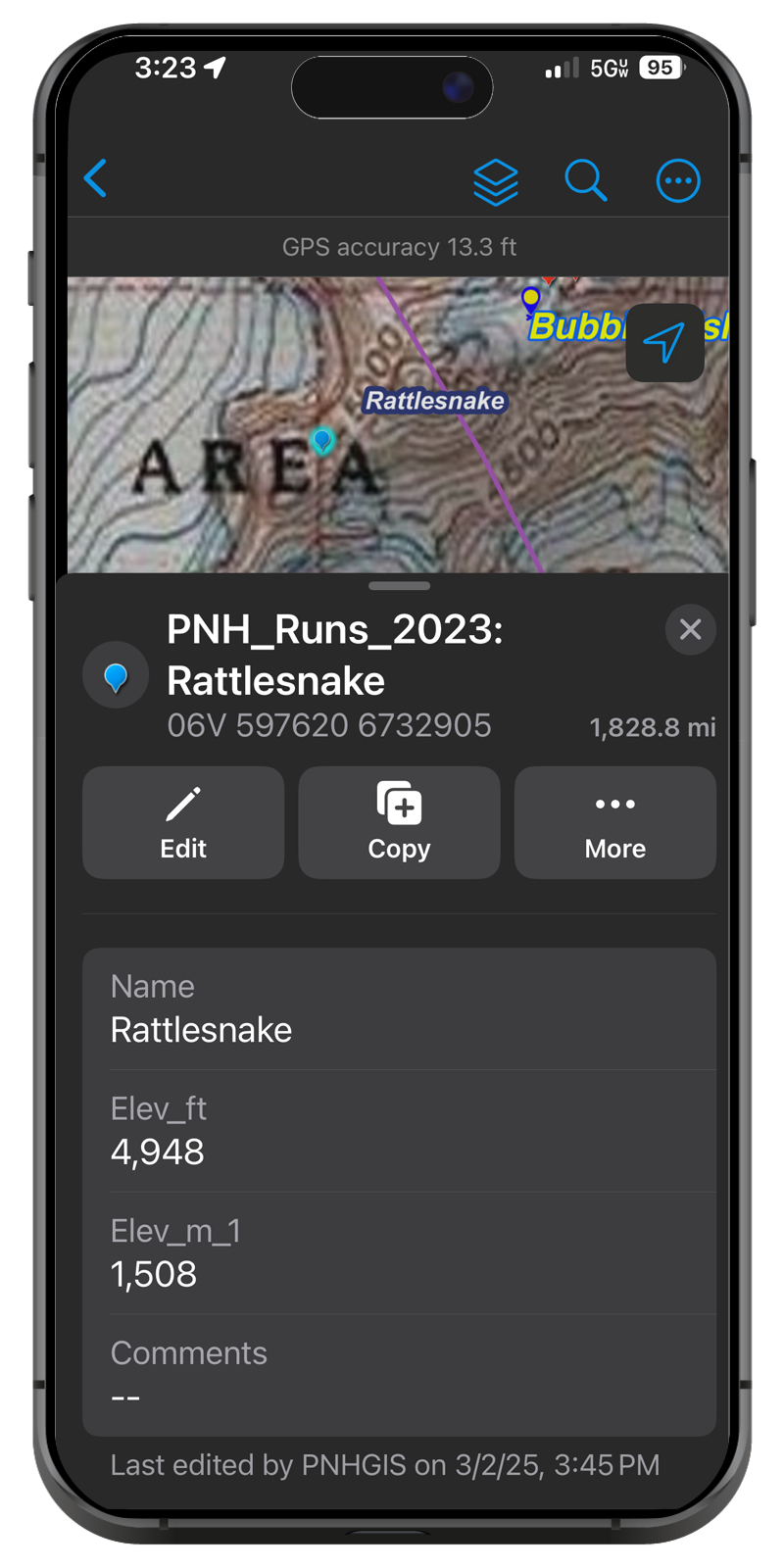
Add any metadata or records your operation requires for any features in the GIS
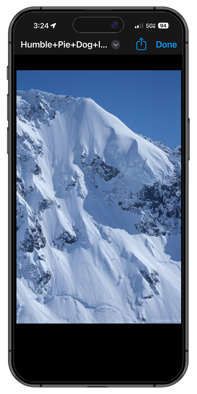
Attach media (photos and videos) to any features in your GIS - such as LZs or PZs, and sync to all users on your team (or clients)
Customized private Geographic Information System for your guided skiing operation, on the industry-leading ESRI ArcGIS platform
Level Up Your Client Offerings
Build a view-only custom map of your Zone for Clients to use in the field and take home with them to show their friends and drool over your terrain all summer
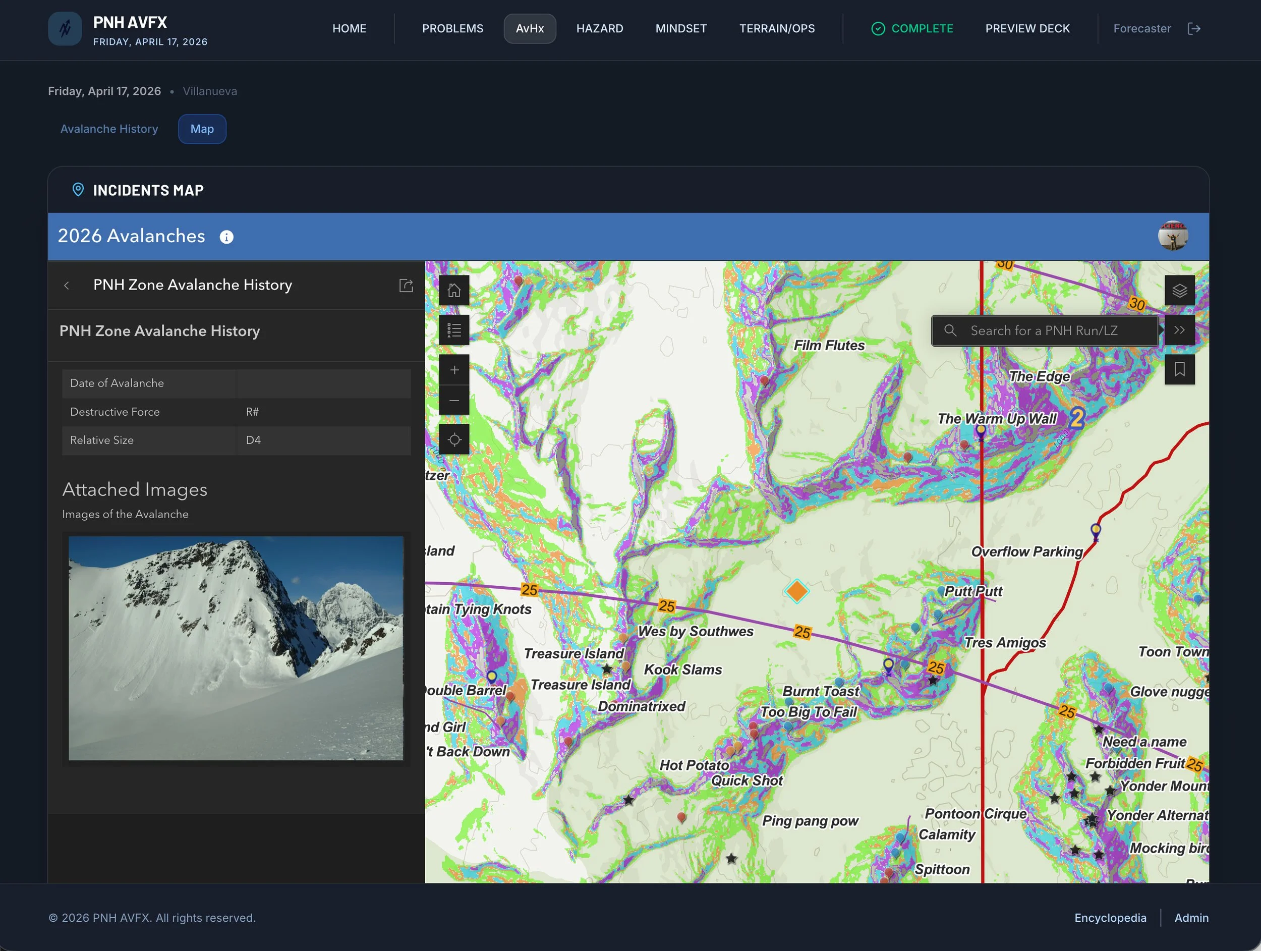
Integrate Avalanche history reporting into the MountainOps Avalanche Forecast Briefing
Give your clients familiarity with your terrain before they arrive